Delivering the World's
LEADING EVENTS
TO THE WORLD'S BUSINESS LEADERS
Find an Event
EVOLVING YOUR EVENT EXPERIENCE
IQPC goes beyond the traditional physical and virtual event experience to deliver enhanced learning and networking opportunities. We offer blended digital learning through our extensive library of white papers, webinars, videos, case studies, and tailored research to keep you ahead of your industry. Our B2B digital communities extend your networking beyond the event to over 1 million members. Our combination of digital content, real world events, virtual events and online communities provides unrivaled learning, network and sponsorship opportunities.


Digital
learning
Access articles, case studies, white papers, infographics, podcasts, and videos addressing your specific industry challenges.
Start Learning Now

Events &
Conferences
Choose from over 1,200 conferences, exchanges and exhibitions from around the world.
Search Events NowFEATURED EVENTS
27 - 28 February 2024
Ashton Gate Stadium, Bristol, UK

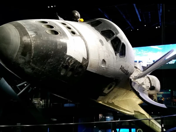
Additive Manufacturing for Aerospace and Space
The 10th Additive Manufacturing for Aerospace, Defence & Space will take place in the new location of Bristol, in 2024.Presented in partnership with Defense IQ
Featuring
Speakers
- Dr Mohsen Seifi - Vice President, Global Advanced Manufacturing Programs - ASTM INTERNATIONAL
- Alexander Champion - Project Manager, Additive Manufacturing - DE&S - UK MoD
- John Sneden - Propulsion Director - >US Air Force Life Cycle Management Centre
- Beth Dittmer - Propulsion Integration Division Chief - US Air Force Life Cycle Management Centre

27 - 29 FEBRUARY 2024
TWICKENHAM STADIUM, LONDON, UNITED KINGDOM

International Military Helicopter
Returning for the 18th annual edition, International Military Helicopter (IMH) 2024 will tackle the highest priorities for the global rotary community, in delivering next generation capability and meeting current threats. Presented in partnership with Defense IQ
Featuring
Speakers
- James Cartlidge MP - Minister of State for Defence & Procurement - HM Government
- Keith Bethell - Director Helicopters - DE&S - UK MoD
- Rear Admiral Daniel Cheever - Nominated Commander, Naval Air Forces - US Navy
- Major General Andrea Di Stasio - Commander - Italian Army Aviation

February 28 - March 01, 2024
The STAR, Gold Coast, Australia
Customer Contact Week Australia and NZ 2024
Prepare to be swept away with the return of the most monumental, unparalleled, and daring Customer Contact event in 2024!
Presented in partnership with CCW Digital
Featuring
Speakers
- Brent Alexander - National Manager – Customer Relationship Centre - Beyond Bank
- Tim Anderson - Head of Customer Experience Design - Entain Group
- Cameron Adams - Head of Go to Market & Strategy - Webex CX APJC
- Rita Arrigo - Strategic Engagement Manager - CSIRO: National AI Centre

20-21 March 2024
ICC, Sydney

Australian Healthcare Week 2024
The Biggest and Most Influential Healthcare Exhibition In The Southern Hemisphere Presented in partnership with Australian Healthcare
Featuring
Speakers
- Sam Peascod - Asst. Secretary Digital & Service Design Branch - Australian Department of Health and Aged Care
- Josie Rudman - Transformation Director and Chief Nurse, New Hospitals Programme - NHS England, UK
- Prof Shirley Bowen - Chief Executive - North Metropolitan Health Service
- Ed Marx - Former Global CIO, Cleveland Clinic - Healthcare Futurist, USA

March 25 - 28, 2024
Orlando, FL

Shared Services & Outsourcing Week March 2024
The Biggest and Most Influential Healthcare Exhibition In The Southern Hemisphere Presented in partnership with SSON
Featuring
Speakers
- Daymond John - Star of ABC’S Shark Tank and CEO - The Shark Group and Presidential Ambassador for Global Entrepreneurship
- Sheryl Connely - Leading Futurist & Global Consumer Trends Expert, Legendary Chief Futurist at Ford Motor Company from 1996-2023
- Angela Mangiapane - President, Mars Global Services, Mars
- Turan Sahin - Chief Executive Officer, Allianz Services
JOIN OUR ONLINE COMMUNITIES
Find new connections, discover new thought provoking research and solve your
industry specific challenges in your dedicated online community.
DIGITAL CONTENT SPONSORSHIP
Are your sales teams demanding more qualified leads?
Are you struggling to develop thought leadership ideas to engage customers and prospects online?
Are you having trouble building an effective online strategy?
Are your social media channels failing to deliver ROI?
EXCEEDING EXPECTATIONS EVERY TIME
Listen to some testimonials from past customers!

CX BFSI Exchange, USA
Customer Service
Development Mananger
BP OIL
"A fantastic opportunity to stop and step outside an insular approach to listen and understand the huge array of opportunities and innovation being created by others within the retail sector and in turn sharing and acting upon this wonderful insight received back in the day job!”
Customer Contact Week
DELIVER WORLD-CLASS SERVICE WITH SPEED & EFFICIENCY
“Started in 1999 as Call Center Week, CCW is the world’s largest customer contact event series. With the balance of conference and expo, CCW is the place where customer care, CX, and contact center leaders come together."
EVENT SPONSORSHIP OPPORTUNITIES
Your sponsorship gives you the chance to personally interact with new customers during their purchasing journey. Our customizable sponsorship packages allow us to match your solutions with customers who are actively seeking help. Sponsoring an IQPC event allows you to:
- Create new customers
- Develop qualified leads
- Convert leads into sales
- Retain customers


KICKSTART
YOUR
CAREER
Join the team that’s consistently pushing the boundaries of innovation in the world of conferences, exhibitions and digital learning.
Because with locations on 6 continents, events in dozens of industries & multiple online communities...